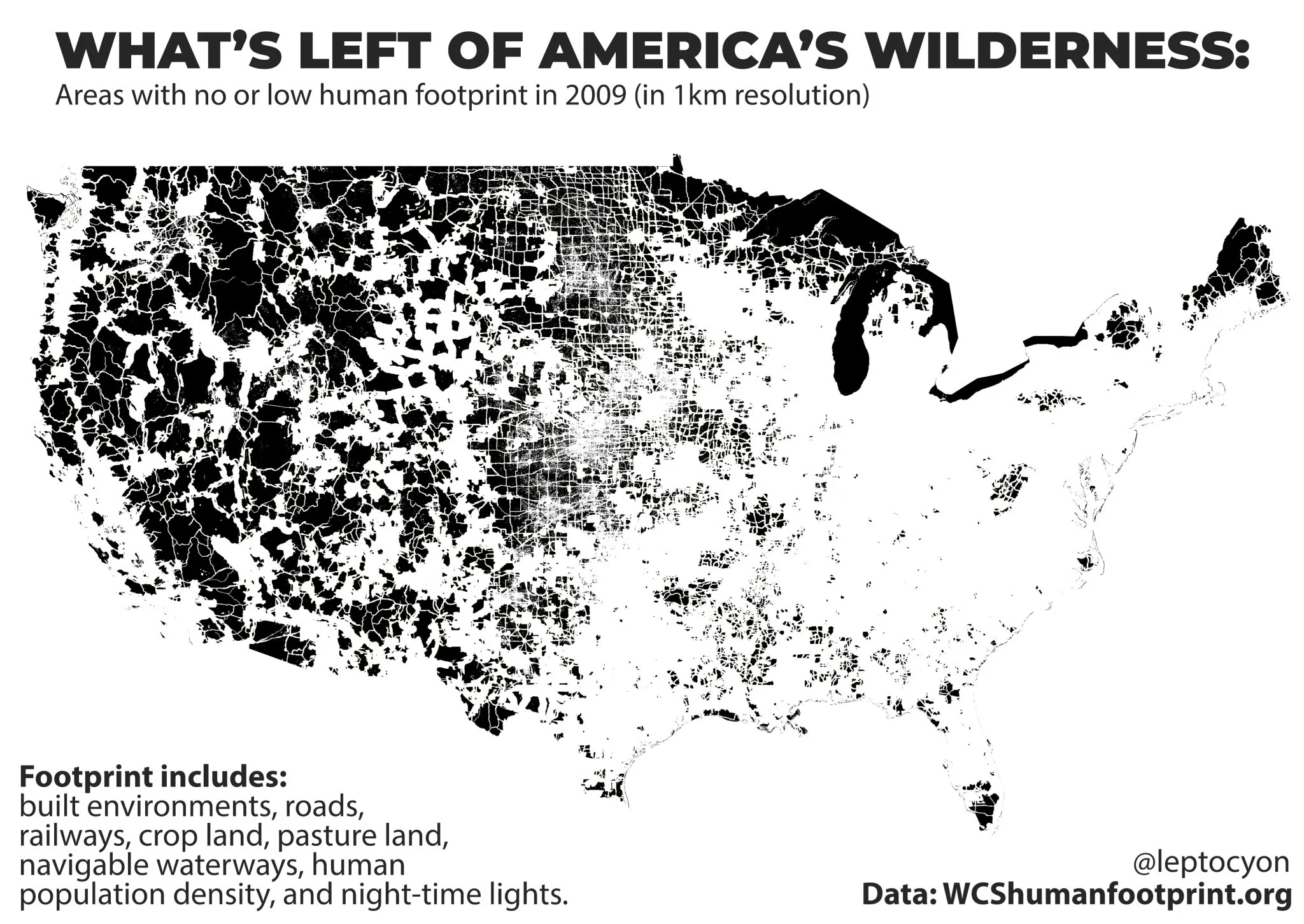
In an age of urban sprawl and constant connectivity, it's easy to forget that vast swathes of the United States remain virtually untouched by human activity. These pristine areas, often referred to as having a low or no human footprint, serve as sanctuaries for wildlife, preserve ecological balance, and offer a glimpse into the raw beauty of nature untamed by human influence.
The Concept of Human Footprint
Before we dive into specific regions, let's understand what we mean by "human footprint." This term refers to the impact of human presence and activity on the environment. Areas with a low human footprint have minimal infrastructure, little to no permanent human habitation, and ecosystems that function largely without human interference.
The map of the U.S. below shows areas with no or low human footprint.
America's Wilderness Havens
Alaska: The Last Frontier
Alaska, aptly nicknamed "The Last Frontier," boasts the largest expanse of wilderness in the United States. The state's vast tundra, dense forests, and rugged mountains harbor countless areas where human impact is minimal. Notable low-footprint regions include:
- Gates of the Arctic National Park
- Wrangell-St. Elias National Park
- Yukon-Charley Rivers National Preserve
The American West
The western states contain numerous pockets of wilderness, thanks to their varied topography and expansive public lands:
- Nevada's Great Basin
- Utah's remote corners of the Colorado Plateau
- Idaho's Frank Church-River of No Return Wilderness
Desert Southwest
The arid landscapes of the Southwest, while harsh, protect some of the most pristine environments in the lower 48 states:
- Arizona's Sonoran Desert
- New Mexico's Chihuahuan Desert
- California's Mojave Desert
Appalachian Wilderness
Even in the more densely populated eastern U.S., pockets of wilderness persist:
- The most remote sections of the Appalachian Trail
- Parts of the Great Smoky Mountains
- Sections of the Monongahela National Forest in West Virginia
The Importance of Low-Impact Areas
These regions of minimal human footprint are crucial for several reasons:
- Biodiversity Conservation: They provide habitats for countless species, many of which are endangered or threatened.
- Climate Regulation: Undisturbed ecosystems play a vital role in carbon sequestration and climate stability.
- Scientific Research: These areas offer invaluable opportunities to study natural processes without human interference.
- Recreation and Mental Health: They provide spaces for outdoor enthusiasts to disconnect and reconnect with nature.
Challenges and Conservation Efforts
Despite their remoteness, these low-footprint areas face threats from climate change, resource extraction, and encroaching development. Conservation organizations and government agencies work tirelessly to protect these wilderness areas through legislation, land management practices, and public education.
As we marvel at these last bastions of wilderness, we must also recognize our responsibility to preserve them. By understanding the value of low-impact areas, we can better appreciate the delicate balance between human progress and environmental conservation.
Further Reading:
- "The Wilderness World of John Muir" by John Muir
- "Last Child in the Woods: Saving Our Children from Nature-Deficit Disorder" by Richard Louv
- "The Wilderness Warrior: Theodore Roosevelt and the Crusade for America" by Douglas Brinkley
- "Wilderness and the American Mind" by Roderick Frazier Nash
- "The Living Wild" by Art Wolfe
- "Into the Wild" by Jon Krakauer
- "The Footprint Press: Environmental Issues in American History" by Mark Fiege

This post may contain affiliate links. As an Amazon Associate, I earn from qualifying purchases.