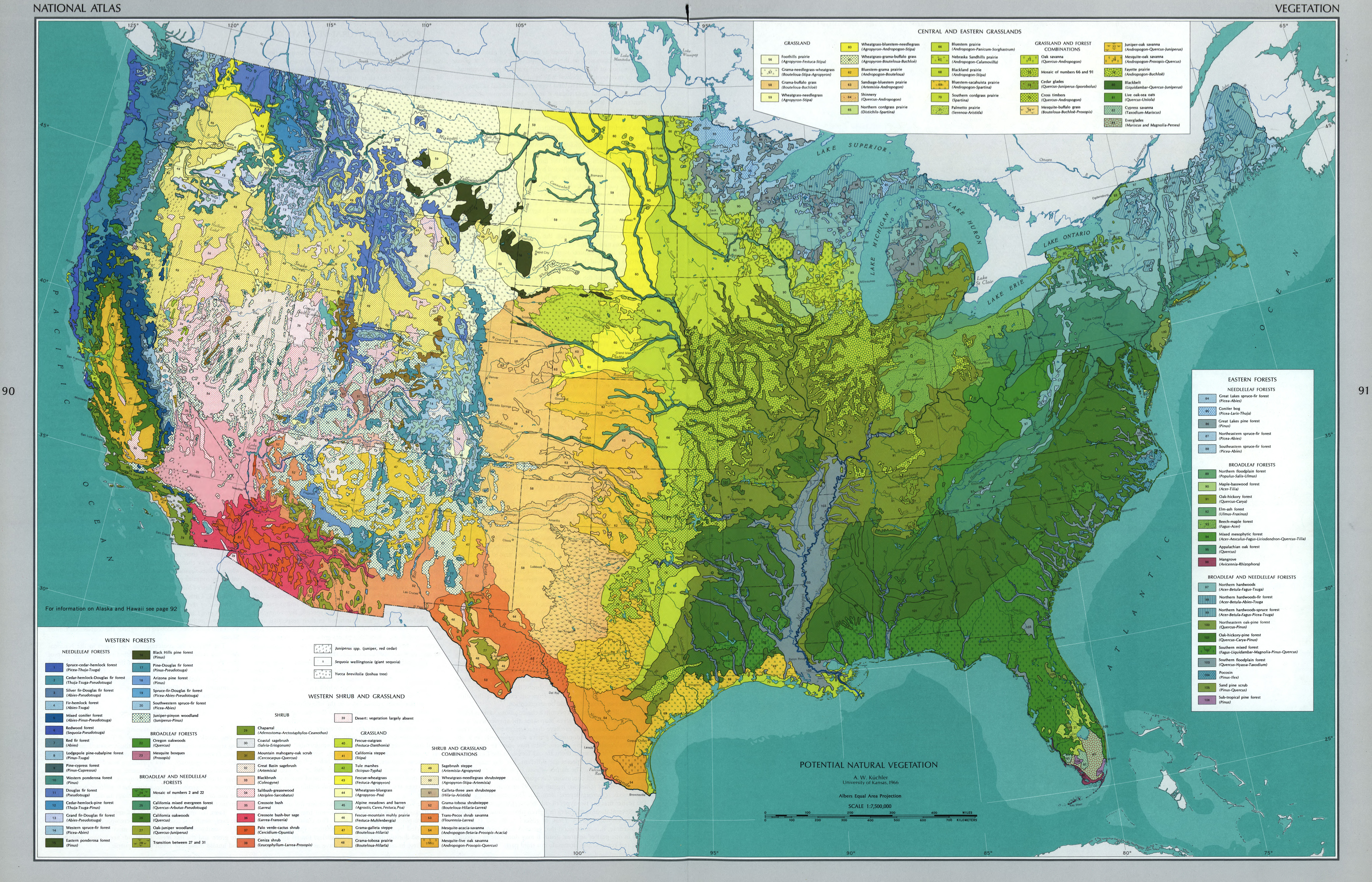
Detailed vegetation map in The National Atlas of the United States of America (USGS, 1970, Gerlach). This 1:7,500,000-scale map, in the Albers equal-area projection, has 119 vegetation classes for needle leaf, broadleaf, and combined broadleaf/needle leaf forests; shrubs; grasslands; and shrub/grasslands combinations; and grassland/forest combinations. Vegetation areas were symbolized using the colors in this style along with, for some classes, overlaid pattern fills.

Via www.vividmaps.com

Via www.vividmaps.com
This post may contain affiliate links. As an Amazon Associate, I earn from qualifying purchases.